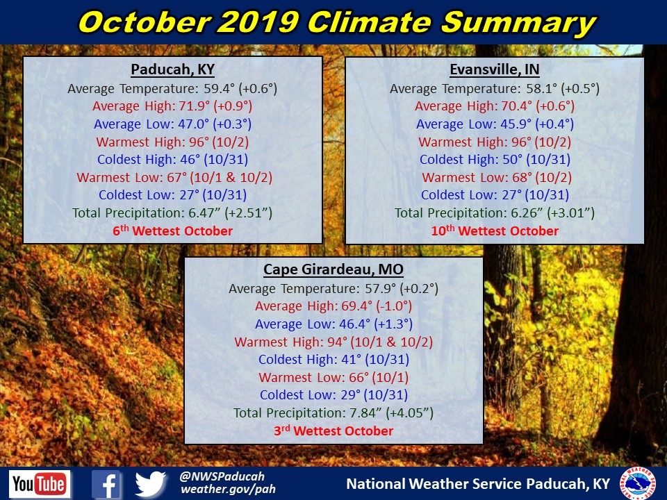


Temperatures averaged near normal this past month with Paducah, Evansville, and Cape Girardeau less than a degree above normal. The month was bookended by extremes with highs in the mid 90s to start the month and lows below freezing on Halloween. Record highs were set or tied at all 3 cities the first two days of the month. For the Henderson/Evansville, the 96 degrees recorded on October 2nd tied for the warmest temperature of the year, the first time that an October day was the warmest for any of these cities.
October was much wetter than average across most the region. Each of Paducah, Henderson/Evansville, and Cape Girardeau areas had a top 10 wettest October, with Cape Girardeau’s 7.84’’ its 3rd wettest. Daily precipitation records were set at all three locations on October 21st and October 26th, which has gone a long way towards ending the drought brought on by the very dry September and start of October. The 3.87’’ on October 26th at Cape Girardeau also set a record for wettest October day. Precipitation was closer to normal in western counties of Southeast Missouri and in portions of the Pennyrile region of Western Kentucky.
Overview and Graphics