


The National Weather Service office in Paducah says numerous thunderstorms formed ahead of a cold front during the late afternoon Saturday. Some supercells and bowing line segments were embedded within the large area of convection through the evening hours. A few transient low-level circulations were observed in the supercells, which exhibited stronger and more sustained rotation in the mid levels of the atmosphere. The bowing line segments produced isolated wind damage.
A damage survey has concluded an EF-2 tornado first touched down in Henderson County causing roof, siding, and fascia damage to dozens of homes along the path. At least a dozen barns or outbuildings sustained roof or structural damage. One large barn was completely destroyed, with debris scattered hundreds of yards from its foundation. Hundreds of trees were snapped or uprooted.
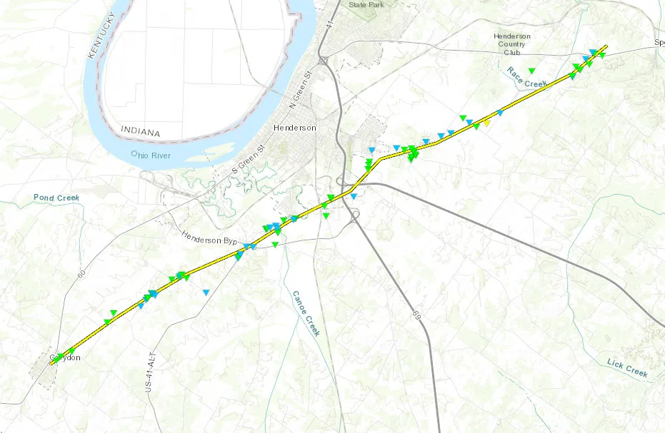
SUMMARY:
Date: Mar 28, 2020
Time (Local) 7:58 – 8:12 PM CDT
EF Rating: EF-2
Est. Peak Winds: 115 mph
Path Length: 17.0 mi
Max Width: 500 yd
Injuries/Deaths 0 / 0
A second twister spawned right on the bank of the Ohio River and then slammed neighboring Newburgh, Indiana according to the damage survey.
Five homes lost at least portions of their roof, and at least one home lost some of its second story walls. Dozens of other homes received moderate to major damage. Hundreds of trees were snapped or uprooted. Dozens of small buildings, garages, and other small structures were damaged. Many power lines were either blown down or brought down by fallen trees. At least two people were treated and released from area hospitals. The tornado was photographed near the beginning of its track along the Ohio River.
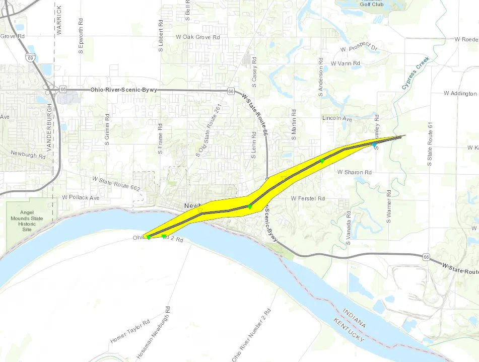
Tornado #2 – Newburgh, IN
WARRICK COUNTY
Date: Mar 28, 2020
Time (Local): 8:18 – 8:25 PM CDT
EF Rating: EF-2
Est. Peak Winds: 125 mph
Path Length: 5.2 mi
Max Width: 575 yd
Injuries/Deaths: 2 / 0
Comments